Waterfalls in Co. Cork, No. 2
Basically, it’s already the 3rd waterfall I introduce, if I take the tiny one into account that is located just behind the Inniscara Dam in Lee Valley. Nevertheless, it is the 2nd one that is worth to go for a walk because of it.
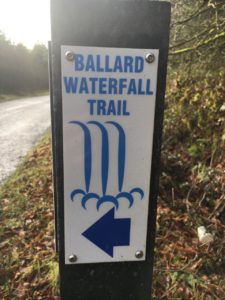
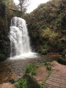
Ballard Waterfall
One of my blog readers made me aware of this waterfall and that’s the reason to be back in North Cork. A big thank you to Matthias! If you hadn’t mentioned it, maybe I’d found it anytime in summer or not at all.
Most of the time I take somebody with me, when walking, except today. And so I tried to make the most out of it because from the afternoon on, the weather was forecasted to turn into the Irish way. Nonetheless, it was at least dry.
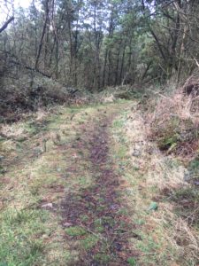
Western entrance at Coachford Road
I started at a small parking area next to the western entrance. For further details, please have a look at the end of that article under Directions.
Once you have your car parked, walk back a few meters and then turn left into the walking path. Pass the barrier and now you can comfortably walk along this forest road.
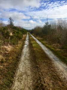
The path is going to be smaller the more you follow it and as it goes downhill, it’s getting to be muddy and slippery. Mind your steps all the time. It has a good gradient. And we don’t have to talk about suitable shoes to wear, do we? This is recommended by itself.
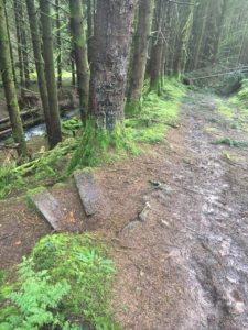
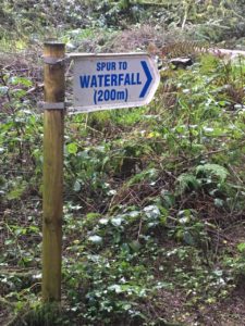
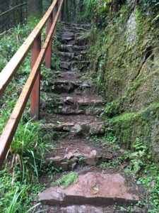
Just before the path is blocked due to fallen trees, there is a path to the waterfall to the left. The wooden stairs down here are provided with spikes. A plus for your safety because there’s an extremely high humidity. Also in summer, it might not be less humid. Maybe the path downwards might not be that slippery, but I wouldn’t bet on it.
Biotope Waterfall
And there you are. In a biotope. An area of special interest, which needs to be preserved, because it is so different to the area around.
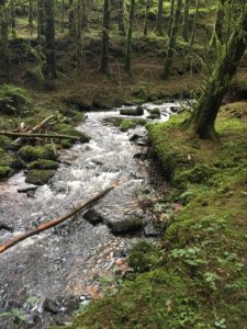
Enjoy that mighty sound of the waterfall in this amazing area. It is so special.
The complete route is shown in that picture:
I made the widest distance in the lower part of the picture. Once from the western entrance to the waterfall and once from the eastern entrance. The rest up to the red walking sign (Mountain Barracks) on the top and down to the eastern entrance, which is marked with a metal bridge, I made by car. This distance is only to walk on a tarred surface. My knees would complain after 10 min. I leave it up to you, what area you want to walk.
Eastern entrance
If you want to start there, keep in mind, that there is only 1 parking spot available directly at a metal bridge to the right and this street is extremely narrow and has its blind zones. The walking path down to the waterfall, however, hasn’t such a gradient as the one from the western entrance and is more comfortable to walk. If you want to start at the western entrance and finish at the opposite entrance or vice versa, you’ll have 3 possibilities:
- Either you have someone who drives the car and picks you up at the preferred entrance
- Or you walk the street back to Mountain Barrack and down to the parking area
- Or you simply walk back the way you are coming from 🙂
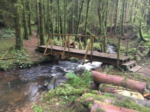
Down at the waterfall area, you have at the moment only the 2 bridges available to cross the stream, which comes from waterfall because the loop walk around the biotope is still blocked by fallen trees.
Directions
Starting from Dunkettle Roundabout take the M8 until Exit 14 towards Kilworth. You have to turn right to Kilworth at some point, but it is clearly signposted. Follow the road into Kilworth and turn right into R667 once you are in Kilworth. Also here the signposting is fine. Turn then left into Coachford Road signposted to Ballyporeen, but keep straight and follow the street to the forest area. Go on and park your car at the 4th entry to the forest at the left-hand side.
GPS: 52°13′19″ N 8°11′23″ W (parking area)
If you want to start at the metal bridge, go on until Mountain Barrack, turn right at the crossing and further until you can turn right again into the earlier mentioned narrow street.
GPS: 52°13′15″ N 8°10′34″ W (parking lot at the metal bridge)
Keep in mind that M8 costs 1,90 € toll, means: to and back 3,80€.
Alternatively, you can use the R639 until Kilworth and follow the description from here. To see more of the countryside, it might be a good decision to go for.
Public transport
For all who are dependent on public transport:
It is an area difficult to reach. There is definitely running a Bus No. 245 to Kilworth. But from there you have only the possibility to go by Taxi. Sorry, for the inconvenience.
But there are a few walking trails in that area, it might be worth to spend a whole weekend here for walking. Let’s see, how we can connect the walking trails to have a better walking experience.
And if you want to join me for a walk or hike, please click here for guided walks in Co. Cork.