From Inchileigh to Ballydaly Upper
Have I ever been excited about the way markings on some hiking trails? Never before! This trail seems to be the famous exception to the rule. It’s so easy to follow the trail, you will never have the feeling to get lost and it’s fabulous.
However, you should be fit, because the trail is a bit demanding. It’s not suitable for buggies. Dog owners could struggle at the stiles here and there, depending on how good your dog deals with such difficulties. We managed every of these stiles, but it sometimes was a bit tricky.
Hiking shoes are definitely recommended. With good shoes the hiking experience will be a good one.
From Inchileigh to Ballydaly Upper
We started our hike in Inchileigh. It’s a bit challenging to get a parking here, but we made it. We parked our 2nd car at the end of this trail, as this walk leads along the bottom line of the Clara Mountain. There’s no turning back.
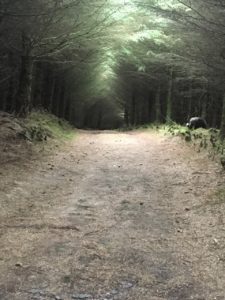
After about 100 m walking along the old tiny road uphill, there is an entrance to the right into a magic forest.
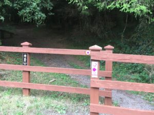
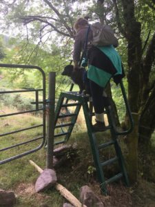
After a while you have to climb over the first stiles to the left. But mostly there is a gate next to the stiles, which can be used as well. Don’t forget to close the gates again after being through. These stiles we will find at least 5 times along this trail.
And then we had to master our first ascent.
Looks definitely harder than it is. Slow down your pace a bit and you will be fine. Almost at the end of that part you can make your first rest under the trees.
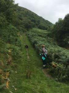
After that part the trail goes on moderately. Here and there a bit up and a bit down, but the trails narrows down when you come near the pastures.
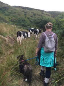
The cows tolerates hiker. Don’t panic!
Once you have passed the live cattle, the trail narrows down even a bit more and the stiles are more difficult to climb over. Enjoy the view over the area.
After a bit more than 2 hours and 6 km whole distance, we ended up at a small street leading down to our car.
Directions
The shortest route is via the N22 and R579, but I took the N20 to Mallow and then the N72 towards Millstreet. About 20 km more, but for me a little more relaxing. Once you are in Millstreet turn off left into Claragh Road after the church which is at the corner.
Inchileigh: 52°3’12″N 9°4’14″W (here we started our hike)
Ballydaly Upper/Clarabeg: 52°2’54″N 9°7’23″W (here we parked our 2nd car)
Sorry for all my readers who are dependent on public transport. There is a train to Millstreet. The distance from the train station to the parking is about 3 km. The next train station would be Rathmore, seen from the end of the walking trail. It’s quite a distance to walk along the roads. That’s why I recommend in such a case my People walking service.